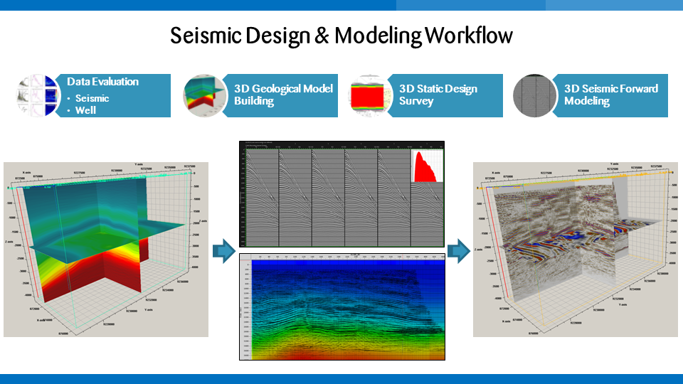
Survey design and planning is the foundation of every seismic acquisition project. Geowave’s survey design experts plan seismic surveys that maximize seismic image quality, operational efficiency, and safety, while ensuring that the recorded seismic energy will accurately image the target.
When planning a seismic survey, there are many factors that influence and inform decision-making at all stages of the process. By modeling multiple acquisition scenarios, our design professionals recommend the tools and techniques to deliver the best images as cost effectively as possible.
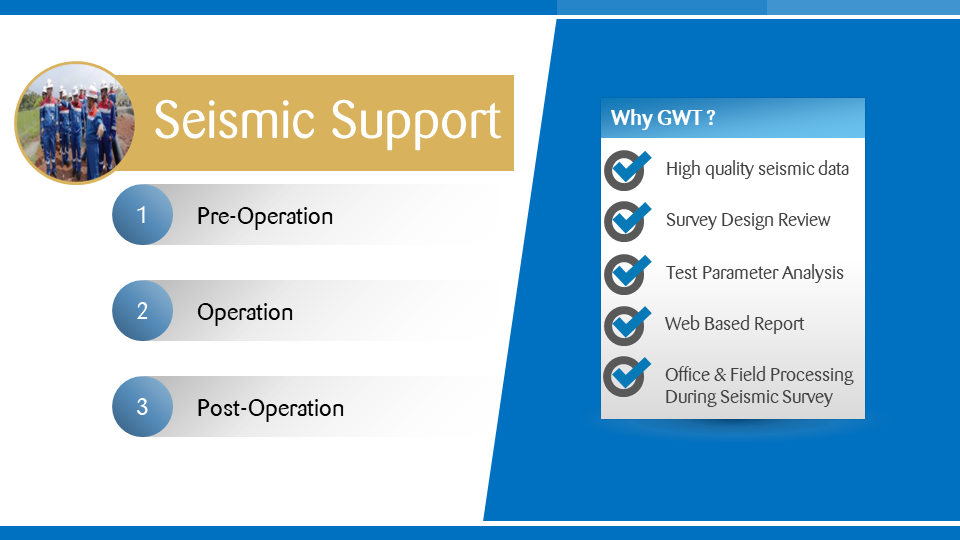
Our seismic support services are available for land operations. We have extensive experience in 2D and 3D acquisition operations with various energy sources on land operations. Our seismic support services constitute survey planning, permit, socialization, quality control, project management, technical audits, HSSE advisory consultancy, and damage claim compensation. To minimize LTIs (lost time incidents), all [...]
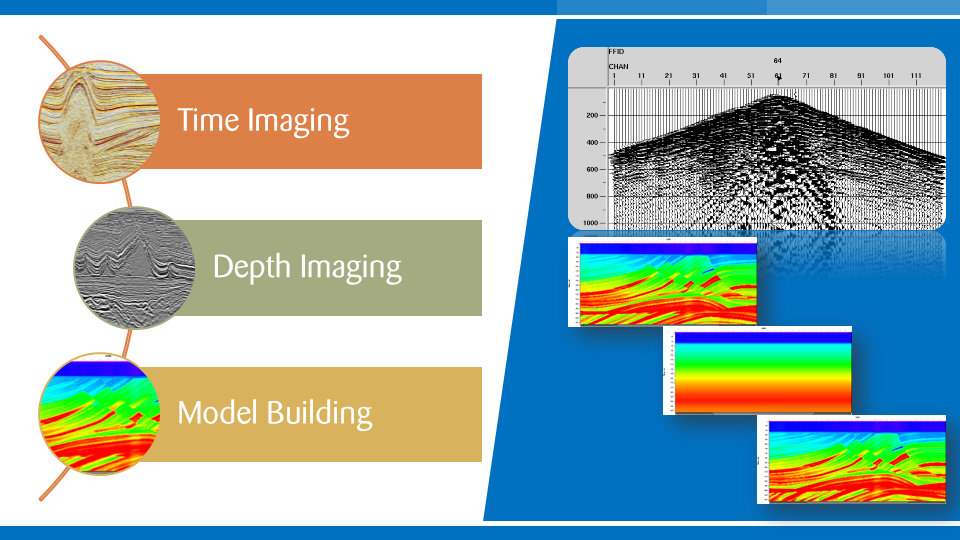
Geowave providing seismic imaging services to the Oil Industry in Indonesia. Our Objective is to generate high quality products with the latest seismic data processing technology in a timely manner. Our experienced and professional personnel achieve this through the implementation of totally integrated systems. Our seismic imaging services include: Time Imaging Depth Imaging Model Building [...]