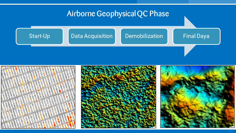
Geowave collaboration with our partner Gondwana Geoscience providing airborne geophysical support services to the oil and gas industry in Indonesia. In 2016 since the establishment of Gondwana Geoscience, approximately 40,000 line km of Falcon AGG and FTG data in Indonesia were QC-ed by Gondwana. The ability to perform Quality Control services is dependent on years of experience of working with the data in both processing and interpretation.
The acquired data should be carefully controlled to ensure the best possible data quality. QC of any airborne geophysical survey can be divided into four phases.
Start-up
A variety of dynamic and static calibrations and tests must be conducted prior to data acquisition to ensure the full functionality of the data acquisition system and to provide all required correction coefficients for data processing. The results of these calibrations and tests should be verified.
Data Acquisition
During the data acquisition phase the data should be checked for adherence to the nominal survey specification and standards agreed upon in the contract. Nominal QC tasks include systematic and visual inspection of the geophysical and auxiliary data including navigation, instrument noise, data recording and the monitoring of environmental conditions such as the accelerations the aircraft is subjected to during flight. Failure to meet contract specifications will be flagged and re-flights will be discussed with the contractor.
Demobilization
This is the most critical part of any QC since all data need to be checked for quality and completeness before the contractor is permitted to demobilize crew and aircraft. During this phase all preliminary data will be checked again for adherence to the agreed nominal specifications and for line-to-line consistency. Final re-flights (if necessary) will be discussed with the contractor.
Final Data
Once the contractor has completed preliminary final processing of all acquired data these will be checked for completeness, data cleaning and processing. The QC team may recommend changes to the data processing and the data will be checked again after the recommended changes are incorporated by the contractor.


